Birmingham canals - a walking guide from Gas Street Basin
The city turned its back on the water for a century. A route along what it rediscovered.
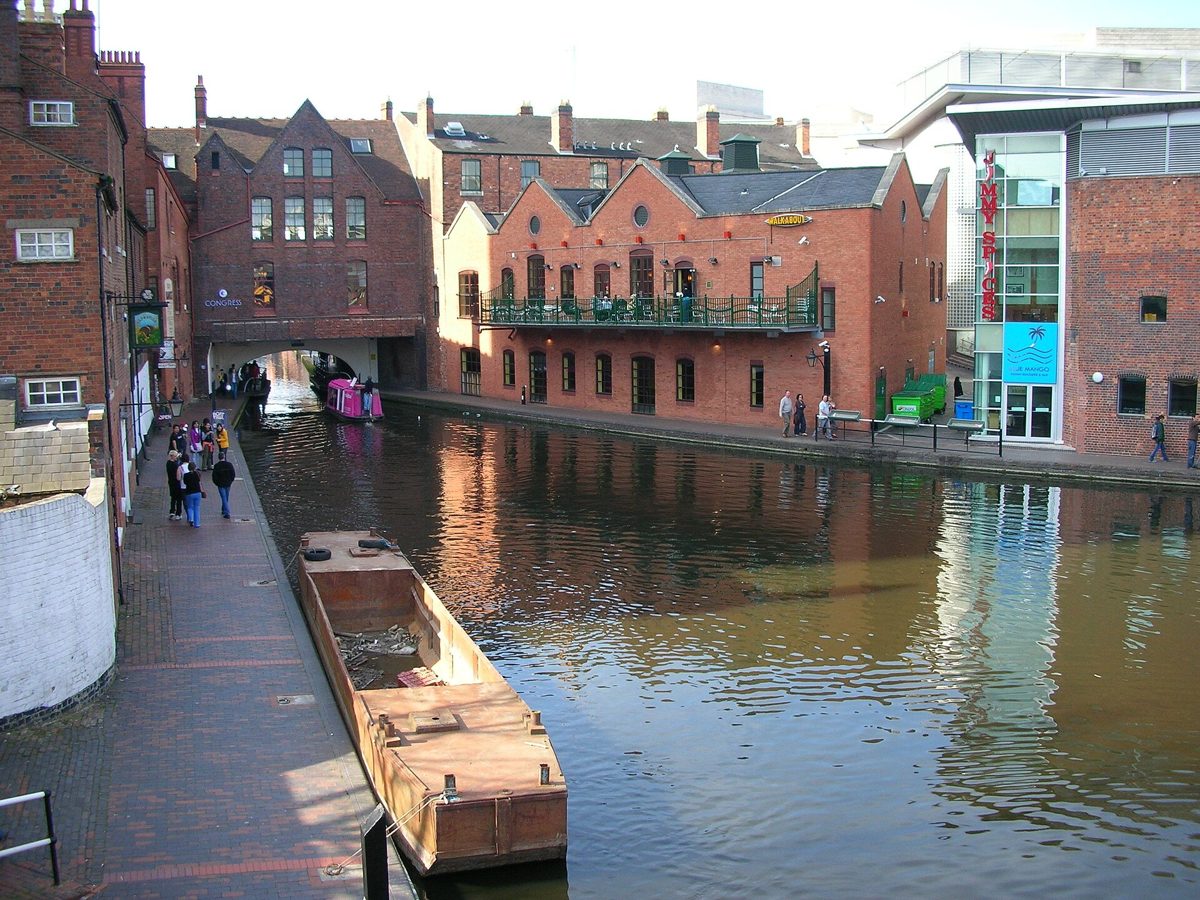
Birmingham's canals were built to move coal, iron and finished goods through an industrial city. Today the towpaths give a walk through basins, locks, bridges and warehouses that still show how the waterway worked. This guide covers six real places and keeps to verifiable history, with no invented venues or statistics.
Gas Street Basin
Gas Street Basin was built as a meeting point between canals, giving boats a place to turn, load and change direction. It survives as one of the most recognisable canal junctions in the city, with narrow boats, brick warehouses and the tight geometry of a working basin.
While walking, look at the junction where routes meet, the basin walls, moored narrow boats and the way bridges frame the water. The mix of old brick, ironwork and modern buildings shows the basin's shift from freight handling to leisure boating without losing its working shape.
The Birmingham Canal Main Line
The Birmingham Canal Main Line was built to carry heavy goods, especially coal and iron, into and out of the city. It survives as the broad, straight route with long brick embankments, bridges and former wharf edges.
On foot, notice how wide and direct the channel is compared with later canals. Look for towpath edges, bridge abutments, old warehouse fronts and the places where side arms once served factories. The Main Line explains the scale of Birmingham's freight traffic better than any single building.
Brindleyplace
Brindleyplace takes its name from James Brindley, the engineer associated with early canal building. The area was redeveloped around the canal, keeping water at the centre of a district of offices, restaurants and public space.
What survives is the canal arm itself, with moorings, bridges and waterside walks. Look at how the waterway is used as a public route rather than a hidden service corridor. The canal here is less about freight and more about how an industrial channel became part of city life.
The Roundhouse
The Roundhouse was built as a stables and maintenance complex for the canal company, giving horses, equipment and workers a base beside the water. Its curved form and canal-side position survive as a reminder that canals needed land-based support, not just water.
While walking, look at the curved brick building, its relationship to the canal and the way it anchors the towpath. It is a good place to think about the labour behind canal transport: horses, drivers, lock keepers and maintenance crews.
The Mailbox
The Mailbox stands on a former Royal Mail sorting office site beside the canal. Its canal-side setting shows how large institutions used water transport and rail connections in an industrial city.
What survives is the canal edge, wharf space and the contrast between older waterway infrastructure and later redevelopment. Look at the canal wall, moorings and how the building turns toward the water rather than turning its back on it.
Worcester and Birmingham Canal towards Edgbaston
The Worcester and Birmingham Canal was built to connect Birmingham with the River Severn at Worcester, giving manufacturers a route to wider markets. Towards Edgbaston it survives as a quieter stretch with locks, towpaths and tree-lined edges.
On this walk, look for lock chambers, side pounds, bridges and the change from dense city to greener suburbs. The canal shows how a route built for commerce now also provides a green corridor through Birmingham.
What to look for on every stretch
Lock gates and their balance beams, which show how water level changes were managed by hand. Towpath surfaces, often stone or brick, worn smooth by horses and later walkers. Bridge abutments and parapets, which reveal where roads and footpaths crossed the water. Warehouse loading doors and hoists, marking places where goods moved between boat and building. Mile posts and boundary stones, which still carry distances and ownership marks. Mooring rings set into the canal wall, used by working boats and now by leisure craft.
Reading the infrastructure
A canal is a machine spread across a landscape, and Birmingham's network is one of the clearest examples in Britain. The width of a channel tells you what it carried. The Main Line is broad because it moved bulk freight such as coal and iron. Narrow canals, like the Worcester and Birmingham towards Edgbaston, were built for smaller boats but linked the city to the wider Severn network. Locks are not obstacles to be endured; they are the mechanism that allowed boats to climb hills and cross watersheds. Each chamber records a change in elevation and a decision made by engineers about cost, water supply and route.
Bridges matter too. A brick arch with a towpath running beneath it marks a place where the canal had to fit under existing roads. A cast-iron bridge, such as those found on several Birmingham arms, signals later strengthening and widening. Warehouses with large ground-floor openings and hoist beams above show where cloth, metal goods or food were loaded directly from boat to store. Even the curves have meaning. A sharp bend often marks a property boundary or a contour that the engineer could not afford to cut through.
James Brindley and the shaping of the network
James Brindley, the engineer whose name survives at Brindleyplace, was associated with early canal building in the Midlands. His routes tended to follow contours, avoiding deep cuts and expensive tunnels where possible. That approach made canals cheaper to build and easier to feed with water, but it also produced winding routes that took longer to travel. Later engineers, including those who worked on the Birmingham Canal Main Line improvements, cut straighter channels and built flights of locks to save distance. Walking from the broad Main Line to the more intimate arms around Brindleyplace lets you see both design philosophies in one afternoon.
A short walking order
Start at Gas Street Basin, where several routes meet and the geometry is clearest. Walk the Main Line to feel the scale of freight traffic, then return toward Brindleyplace for the canal arm and waterside public space. Continue to the Roundhouse to see the stables and maintenance complex, then pass the Mailbox, where a former sorting office sits beside the wharf. Finish by heading south along the Worcester and Birmingham Canal towards Edgbaston, where locks and tree-lined towpaths soften the industrial edge.
Frequently asked questions
Does Birmingham really have more canals than Venice?
The phrase is often repeated, but it compares the total length of Birmingham's waterways with Venice's. It says nothing about character, setting, architecture or how the canals are used. Venice's canals are part of a lagoon city; Birmingham's are industrial waterways adapted for modern walking, boating and city life.
What is the best way to understand canal history on foot?
Walk slowly and read the infrastructure rather than chasing landmarks. Locks show changes in water level, bridges show where roads crossed, warehouses show where goods were stored, and towpaths show how horses pulled boats. A short stretch with attention to these details teaches more than a long hurried route.
Can I walk all of these places in one day?
Yes, the six places can be linked by towpaths and city streets, but the value is in stopping to look. Gas Street Basin, the Main Line, Brindleyplace, the Roundhouse, the Mailbox and the Worcester and Birmingham Canal towards Edgbaston form a compact urban walk. Allow time for locks, bridges and waterside details rather than treating the route as a checklist.
This is an independent member's guide compiled by Birmingham Society. We are not affiliated with the venues and institutions mentioned; opening arrangements and programmes change - always confirm details on the official websites before making plans.
← Back to Events